Powered by
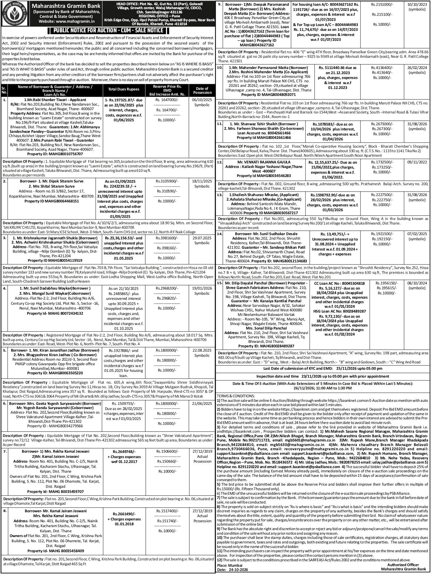
Residential Flat No. 001, situated on the Ground Floor, Wing A, of the building known as “VinayakBalaji Arch”, constructed on land bearing Survey No. 200/1, located at Village Kasheli, Taluka Bhiwandi, District Thane, Maharashtra.
The residential premises have a built-up area of 550 sq. ft. (approximately 51.10 sq. metres). The carpet area and super built-up area have not been specified in the supplied property description.
The flat forms part of VinayakBalaji Arch, a residential building situated in Village Kasheli, within the Bhiwandi region of Thane district.
The premises are specifically located on the Ground Floor of Wing A. The flat's internal configuration, number of bedrooms, bathrooms and parking arrangements have not been provided.
The property is constructed on land bearing Survey No. 200/1, which serves as an important identification reference in the official revenue and property records.
Kasheli is a residential and commercial locality in the Bhiwandi region, with road connectivity towards Thane, Kalher and surrounding areas.
The wider locality includes residential developments, commercial establishments, local markets and industrial activities. The proximity of educational institutions, healthcare facilities and public transportation should be independently verified.
The ground-floor location may provide convenient access to the premises, subject to confirmation of the building entrance, access arrangements and physical condition.
The availability and condition of water supply, electricity connections, drainage, parking and other common building facilities should be confirmed through physical inspection.
The property may be considered for residential occupation, rental purposes or investment, subject to verification of ownership title, sanctioned building plans, applicable permissions, physical condition and possession status.
The premises are specifically identified by Flat No. 001, Ground Floor, Wing A, VinayakBalaji Arch, Survey No. 200/1, Village Kasheli, Taluka Bhiwandi, District Thane, which should be matched with the registered property documents and official land records.
The source states “Boundaries as per record.” However, the individual boundary descriptions have not been supplied and should be verified from the relevant property documents.

 Property Details
 Auction Date
 Region
 Flat
 Budget